

Tuesday 11th August.
Learning Intentions: To locate and map accurately Sunshine Coast and Gold Coast beaches. To locate major landmarks within Queensland.
1. Draw the North, South, East, West diagram in the N.E. corner of the map.
2. Locate the following beaches and mark with a blue dot. Use the button link or map above.
Golden Beach
Dicky Beach
Maroochydore
Coolum Beach
Noosa Beach
Label out to the eastern side. Be very careful to mark them in order.
3. Locate the following beaches and mark with a red dot.
Label out to the eastern side. Be very careful to mark them in order.
4. Mark the Pacific Ocean.
5. Label the Great Barrier Reef from start to finish by drawing a purple line.
6. The Gulf of Carpentaria is where? Mark with a green arrow and label.
Tuesday 4th August and Wednesday 5th August
Task: Learning Intentions:
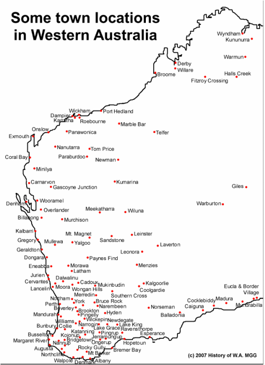
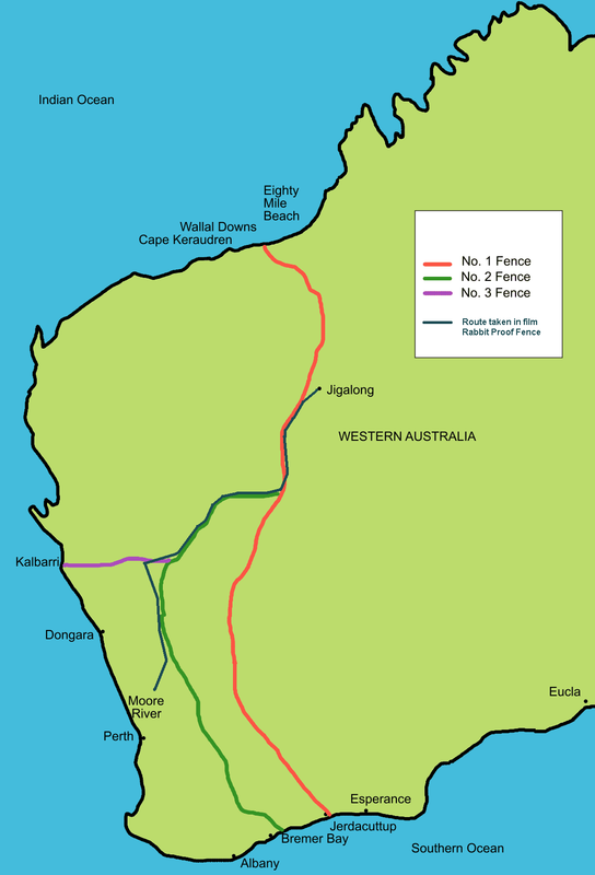
Use the map of Western Australia supplied to:
(1) accurately draw fences 1 (red), 2 (green) & 3 (purple) using a sharp colour pencils noting the town at beginning and end. Add a 'key' at the side of your map. (scroll down for these maps).
(2) record the two mission settlements (blue dots 1 and 2) in the time of A.O.Neville as follows: (1) Mogumber at Moore River and (2) Carrolup near Katanning. Add a key at the side.
(3) record the city of PERTH with a large yellow dot and write the name neatly to the side.
(4) record the towns Derby, Broome, Port Hedland, Exmouth, Carnavon, Geraldton, Freemantle, Albany, Esperance as coastal towns.